CT to FL Day 19
McClellanville, SC to Charleston, SC

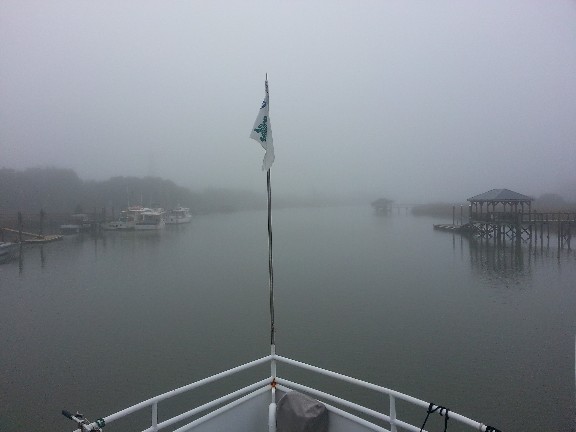
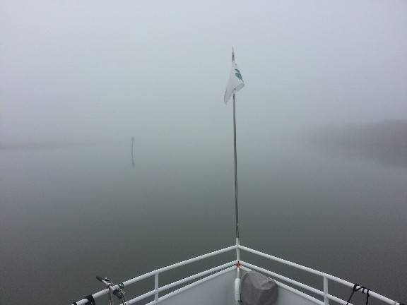
We awoke this morning at 0530 for an early departure planning to go Beaufort, SC but found it to be very very foggy... could barely see the bow of the SAILS from the pilothouse windows. I already knew it was going to be dead low tide and could of dealt with the shallow water but this fog was something else. I went back to bed and set my alarm for 0630... sunrise was at 0700.
Alarm went off as set at 0630... I got up and checked to see if the fog seemed any better with the sun coming up very soon... I think it was actually worse than earlier. Dead low tide... pea soup think fog... we're not leaving today I thought to myself.
Checking the weather the forecast was for the fog to disappear around 1000 so we waited... waiting would also help with the tide... we had a good breakfast and about 0845 the fog appeared to be better as we could see maybe an 1/4 of mile down the canal... a lot of fishing boats had left so we made the decision... we're off... 0900 we tossed the dock lines and were underway out the canal toward the ICW.
We got into the ICW and the fog seemed to zoom in around us and we had less than 1/8 of a mile visibility... we continued slowly radar running and eyes staring into the mist.
The tide had come in quite a bit... the depth sounder was bouncing around between 6 and 7 feet... barely moving at 4.5 knots... it really sucked!
So, we moved on to plan B... scratched Beaufort and changed to Charleston. We wanted to stop at a marina that had a courtesy car so we could pick up some provisions... We would go to St. John's Yacht Harbor on the Stono River just south of Charleston.
About 6 miles north of Price Creek we heard a boat hailing another boat we had passed the day before... they switched from 16 to 68 on the VHF and we also switched to listen in and try and determine their location... the boat hailing was a trawler and they were hailing a sailboat we had passed yesterday... anyway, the sailboat was not hearing the trawler and they never connected on 68... the trawler was asking about fog conditions on the ICW... I hailed them and we switched to 68 and I reported the fog conditions to them as 1/8 visibility and they thanked me.
About an hour later we were just past Price Creek and I started getting a blip on the radar of a boat ahead of us... could not see it but it was there... we were catching it...as we got within visual range they hailed me... it was the trawler we had talked to earlier they had been anchored in Price Creek and had just left hoping things were better than I reported to them... we chatted for a minute or two and they asked me to take the lead and they followed me... sure not a problem. I passed and they stayed close behind us... in fact they followed us all day until we reached Charleston and the fog had cleared... then they passed and continued ahead of us down Wapoo Creek and through Elliot's Cut. We exited the cut and turned to port and they continued down the ICW. They too were headed to Beaufort tomorrow so our paths may cross again.
We arrived to St. John's Yacht Harbor and were securely docked at 1445. Our location approximately N32°45.225', W080°00.613'. We traveled for 5.75 hours covering 38 nautical miles averaging 6.6 knots.
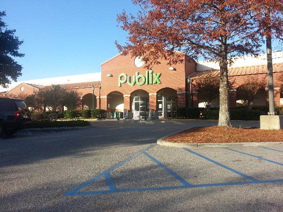
We checked in at the marina office right away and registered for the courtesy car and we were off to Publix... Susan was excited to get to go to Publix for the first time since we left Punta Gorda in April.


