FL to CT - Day 39
Atlantic City, NJ to Bay Head, NJ

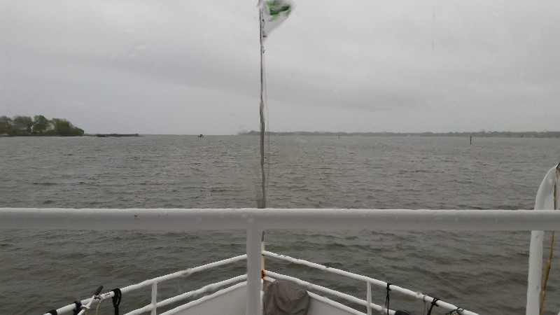
Checking weather this morning we found that conditions offshore were deteriorating... winds were increasing to NE 15 - 20 knots with 25 knot gusts and 4-5 seas with a very short 7 second period. This was much worse than what we had just had coming from Cape May to Atlantic City yesterday. So we made the decision to transit north inside from Atlantic City to Manasquan, NJ.
We departed at 0630 and headed west toward the NJICW had a slight current against us for about an hour and then we picked up a boost as we approached Little Egg Inlet. Of course immediately past the inlet the current was back on our nose slowing us down to less than 6 knots. An our or so north of the inlet the current subsided and we were running at normal speed 6.5 to 7.0 knots.
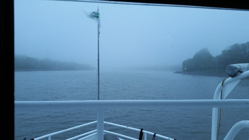
Several places we were at idle speed despite any currents as it was just too shallow to run any faster. Depths running less than 6 feet at first it was just in some of the typical problem areas but several places we ran at idle for miles with depths not even registering on the depth sounder... sounder flashing 5.0 and LAST over an over on screen. Sounder does not function well when it's under 5 feet deep... there is only 4 inches between SAILS' bottom and the actual bottom... YIKES!
We did mange to make it through all the way to Bay Head, NJ just before the Point Pleasant Canal where we had to make a decision as to continue up the canal and out Manasquan Inlet and on to New York... looking at buoy reports we saw sea state to be waves 5.6 feet off Barnegat and 4.1 feet at the entrance to New York Harbor... ENE winds at over 20 knots both buoys. We also had been monitoring several boats on the VHF that were offshore moving north... many were looking for options to exit and come inside and all were reporting heavy short seas... even a couple of fishing trawlers talking to each pulling there dredges and heading back in. These reports made the decision for us... we looked for somewhere to anchor for the night and hope for better conditions in the morning so we could continue on to New York and then Connecticut.
We found an anchorage on Active Captain labeled Metcalfe that was just at the south end of the Point Pleasant Canal and would make a good staging point for leaving in the morning... fingers crossed that conditions would improve overnight.
We stopped for the night at 1530 and anchored at
N40°03.947’, W074°02.937’. We traveled today for 9 hours covering 53.0 nautical miles averaging 5.9 knots.
FL to CT - Day 38
Chesapeake City, MD to Atlantic City, NJ
We were lucky to have our friends Jim and Cathy Fisher drive to Chesapeake City to visit us... we try to get together with them here when it works out... We had a great evening with them on SAILS... was really good to see them.
To optimize the current as much as possible we departed from Chesapeake City at 0600 while there was still a slight flood current... we hoped to ride it to the end of the C & D Canal where we would enter the Delaware River and catch the Ebb tide running to Cape May, NJ.
This sort plan sort of worked but we did have some times that the current was against us but for the most part we had current in our favor.
It was very cold this morning and also very foggy... shortly after leaving the Coast Guard announced on the VHF that due to fog the C & D Canal was closed to all traffic... we were already underway... we continued... they made this announcement several times as we transited the canal east toward the Delaware River. Just as we exited the canal they announced the canal was now open to traffic... there were several commercial vessels anchored just outside the canal... guess they were waiting to get the ok to enter. I think the announcement was directed at commercial traffic rather recreational boats... we were not the only recreational boats moving... both boats that had been at the docks with us were also moving... :)
We had the fog all day except for going through Cape May... it was clear as could be for the 4 or 5 miles across the Cape May Canal, Cape May Harbor and out the inlet... just at the end of the inlet we ran into the fog again... it was like a wall.
Since we had arrived to Cape May so early we decided to continue on to Atlantic City... it's about 5 hours longer and that would get us in about 1900... but we did not get current back so the trip up the coast took a little longer. It was also fairly rough conditions... large swells from the east... that were pretty close together and made the ride a little more unsettling for Susan and Lily.
Even with fog we did see a couple of whales breach very close to SAILS. They were both bigger than SAILS... would hate to run into one... I assume they were right whales. Very cool to see them.
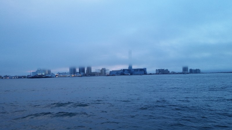
Just as we arrived the Atlantic City the fog started to clear and lift forming what looked like low clouds around the buildings in Atlantic City... looked pretty neat.
We arrived to our destination at Gardener's Basin and were securely docked at 2000. Our location for the night
N39°22.600’, W074°25.265’. We traveled today for 14 hours and 30 minutes covering 99.6 nautical miles averaging 6.9 knots.
FL to CT - Day 37
Edgewater, MD to Chesapeake City, MD
We got a way a little later than planned leaving at 0700 and heading back out to the Chesapeake Bay with it lightly raining and a little windy. It had rained all night long... not terribly hard but steady and it did not look like it was going to stop real soon... radar showed us totally in the middle of a huge band of rain moving NE across us... it was a gray dreary morning.
A horrible day but still lots of people out fishing... and quite a bit of commercial traffic... tugs and barges moving both north and south.
We arrived to our destination at Chesapeake City town docks at 1500. Our location for the night
N39°31.628’, W075°48.668’. We traveled today for 8 hours covering 56.0 nautical miles averaging 7.0 knots.

