FL to CT Day 12
Jekyll Island, GA to Kilkenny, GA

The short day yesterday allowed me to catch up on a lot of work that had been accumulating... worked all afternoon and later in the evening not going to bed until about 0100.
The wind continued to blow 20 knots plus all night and when the alarm went off at 0600 it was still howling outside... I did not hit the snooze button... I hit the "OFF" button and rolled over... slept in a little longer this morning.
However, with me working Susan had gone to bed around 2100 and when the alarm went off she was up and ready to go... So, she had everything ready to go when I awoke an hour later at 0700... all I had to do was get up, get dressed and start the engines. We were underway at 0730 heading out Jekyll Creek toward Brunswick.
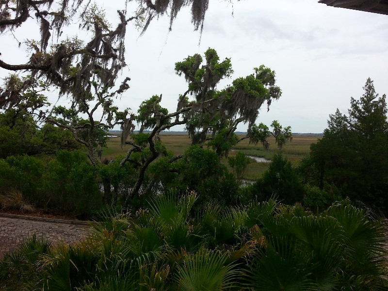
We did have a few sounds to cross to day and it still very windy... 20 knots sustained out of the NW with gusts to 35 knots... and it was overcast and just not a very nice day at all. Surprisingly, there were some boats moving north and south... all larger yachts or trawlers... anyway, the sounds were fine... it was the approaches to the sounds that were nasty... they all were fairly long and running NW, so the wind was blowing right straight down them kicking up 3-5 waves kicking up a lot of spray that was pounding the pilothouse windows.
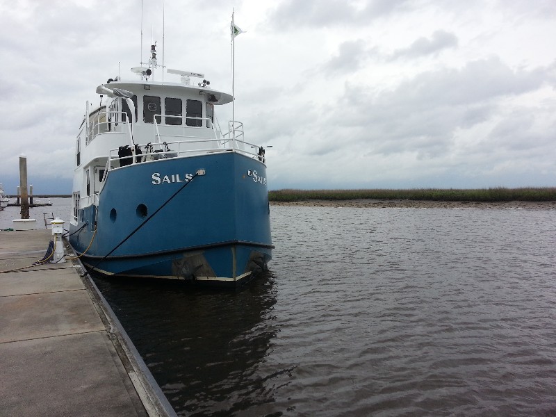
In the waves I found out that my mast had rusted out at the bottom... a couple off the 5 footers in a row and we heard a loud bang from the pilothouse roof... the mast had lowered itself with the rusted out portion giving way... not good... when it fell it also took out both our VHF antennas with it... breaking the 8 ft. extensions where they hit the edge of the pilothouse roof... I'll try to make some make-shift repairs to allow us to use the mast and antennas on the rest of the trip.
We arrived to Kilkenny Creek Marina at approximately 1815... our destination for the night located at approximately N31°47.314', W081°12.155'. We traveled today for 10.25 hours covering 62.5 nautical miles averaging 6.1 knots.
Posted at 6:26 PM
FL to CT Day 11
Fernandina Beach, FL to Jekyll Island, GA
Woke this morning to 46 degrees outside... went to bed with the AC on and it switched to heat in the middle of the night... Susan had to wear her winter jacket to walk Beecha this morning... LOL
It was interesting getting away from the dock this morning as there was a very strong current that wanted to push SAILS immediately away from the dock as soon as any line was removed… but we made it away safely at approximately 0730 and soon were heading out Lanceford Creek toward the ICW.
The winds had howled all night long and were still steadily blowing over 20 knots out of the northwest. This would make the inlets rough as we crossed them... particularly St. Andrew Sound which is full exposed to the Atlantic.
Crossing St. Mary’s Inlet was first one we had to cross… it is fairly protected from the NW winds and it was choppy… 3-4 waves… no sweat! Soon after crossing the winds started to pickup… 25 knots sustained with gusts to 35 knots…even the ICW was rough on the NW stretches… approaching St. Andrew Sound on the Cumberland River we were seeing 3-4 waves… we opted to not cross the sound and take an alternate back router turning to port in to Floyd Creek just north of ICW marker 40. This is marked as an alternate route on the charts… it adds about an 30-45 minutes to route… but much much calmer… need to have a good tide level as there are a few skinny places that are less than 5 feet at MLW. The back route returns you to the ICW just south of Jekyll Creek… ICW markers 25 and 27.
Just before this turn we had a small 25 – 30 foot boat arrive at our stern… I assumed he would hail us to pass… NOPE… he stayed 300 feet behind us… I believe using us to break the waves and smooth his ride… he followed us into Floyd Creek and the rest of the day until we stopped and he continued north.
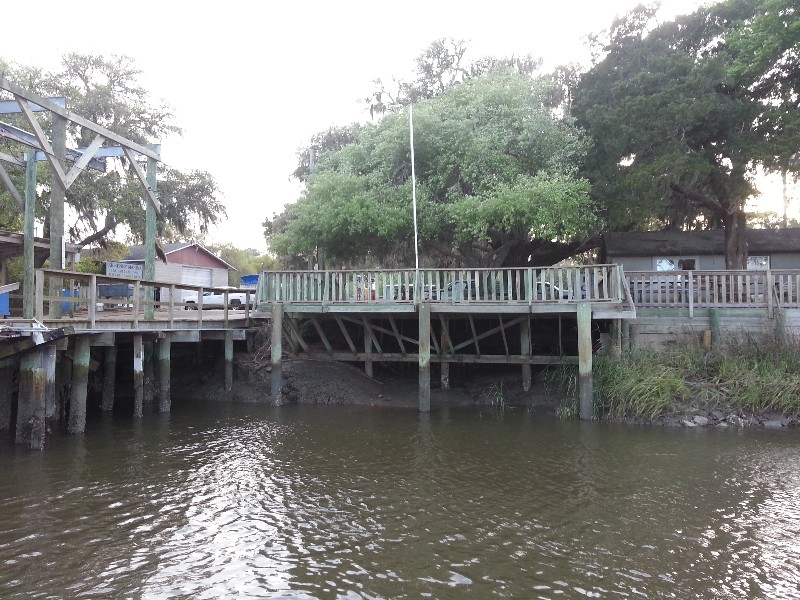
It was a nasty windy day and I really needed some computer time to catch up on some of the cabinet design and web work that had come in over that last few days… so we opted to stop early at Jekyll Island. We arrived to our favorite free dock and were secure at approximately 1300 at N31°02.545’, W081°25.390’. We had traveled for 5.5 hours covering 34.65 nautical miles averaging 6.3 knots.
Posted at 5:38 PM
FL to CT Day 10
St. Augustine, FL to Fernandina Beach, FL
Set my alarm and got up at 0200 to see the lunar eclipse... stayed up watching for 30 minutes and went back to bed... figured I would see photos people that stayed up all night to watch it... I opted to sleep.
Alarm went off at 0615... the lunar eclipse watching for some reason made getting out of bed and going a little slower than normal... hit the snooze for 15 minutes or so before finally rising to a beautiful skyline just before sunrise.
Feed Beecha breakfast and off to land on the dinghy to walk Beecha. She decided this morning was the morning she wanted to dilly-dally... normal 10 minute walk turned into a half hour plus... did not get back to SAILS until after 0700... still had to do the engine checks and prep SAILS for the days cruise.... Destination for the day Fernandina Beach.
We dropped the mooring pendant at 0745 and were underway north toward the St. Augustine Inlet... a strong current against us... but this was good as soon as we crossed the inlet we would have a favorable current all the way to Fernandina Beach. In fact we had times we were doing almost 10 knots with he current pushing us... There were only a few short stretches that slowed us down... love these days.
Had one boat pass us and we passed one sailboat... other than that there was virtually no one else out on the water... could of had something to do with the approaching weather front... we were lucky and seemed to skirt through with very little rain... wind picked up a few times but for the most part the bands of rain passed in front and behind us.
We had hoped to stay at the Fernandina Harbor Marina and called them to check on availability and was told they were sold out... I know the MTOA Southern Rendezvous is taking place there now... we had planned to attend as we do every year but this year with the issues with SAILS we were not sure if we would get there in time so we canceled our plans to attend.
Anyway, we had a certificate for a free complimentary night at The Oyster Bay Yacht Club just a couple miles west of the Fernandina harbor Marina so we contacted them to verify the free night offer was still valid...
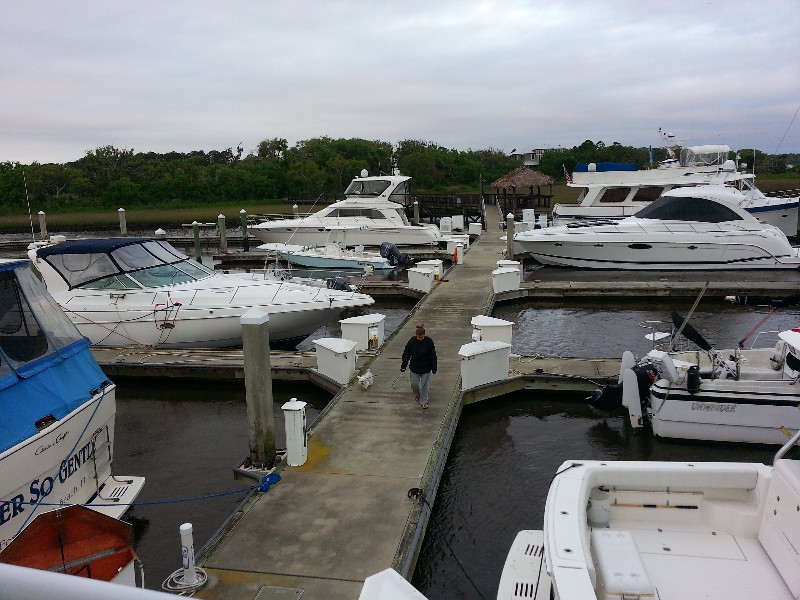
IT WAS! So we turned west out of the ICW at Fernandina Harbor Marina and were soon pulling up to the docks at The Oyster Bay Yacht Club. At approximately 1530 we were secure to the T-head of dock C at N30°39.943', W081°30.299'.
We traveled today for 7.75 hours covering 55.8 nautical miles averaging 7.2 knots.
Posted at 3:58 PM

