CT to GA Day 20
Beaufort, SC to Savannah, GA
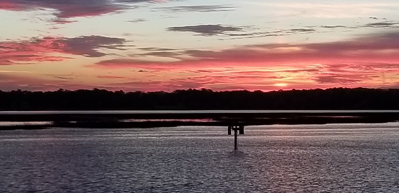
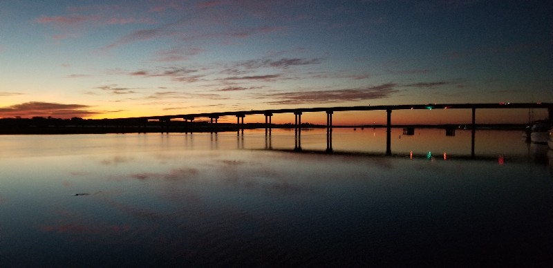
We left the mooring field this morning at 0700 just before sunrise... it was a beautiful sunrise... took a few photos but none really did it justice... the colors kept changing... I must say it's a nice way to start the day.
We saw absolutely ZERO boats moving today... cruisers or local recreational boats... it was really weird to be honest. It was a nice day sunny with a light breeze... seemed like there should of been some boats out.
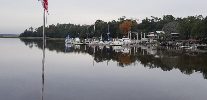
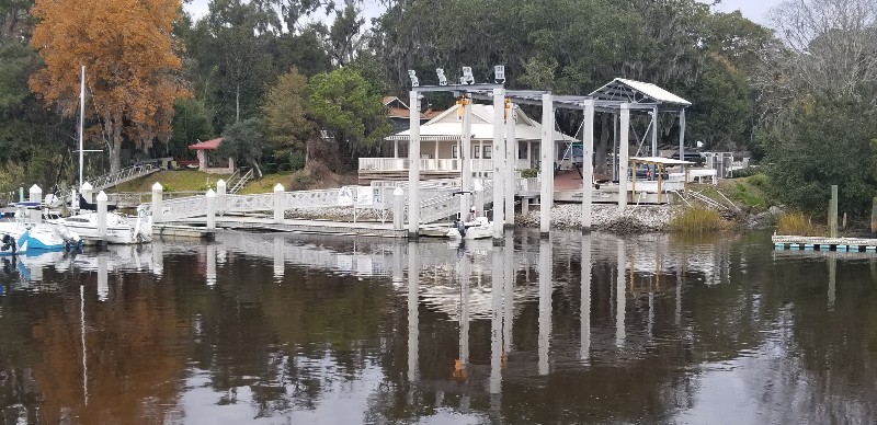
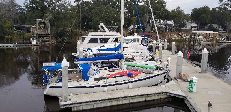
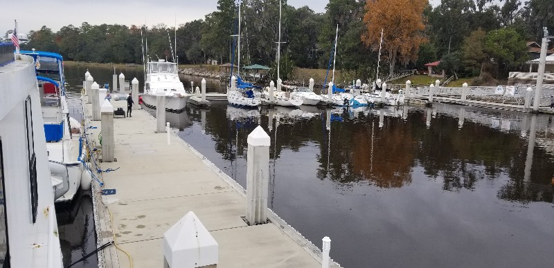
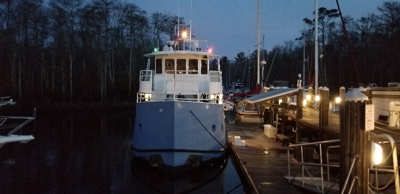
This was the last day of trip south reaching our final destination for winter... Coffee Bluff Marina in Savannah, GA. We arrived at 1500 and were securely docked by 1515. Our position for the next few months is
N31°56.124', W081°09.269'. We traveled today for 8 hours covering 59.4 nautical miles averaging 7.4 knots.
Coffee Bluff Marina is very small with only 20 slips... a few photos...
Posted at 5:32 PM
CT to GA Day 19
St. Johns Island, SC to Beaufort, SC
We pulled anchor and were underway at 0700 leaving the St. Johns Island / Charleston area... planned destination today Beaufort, SC.
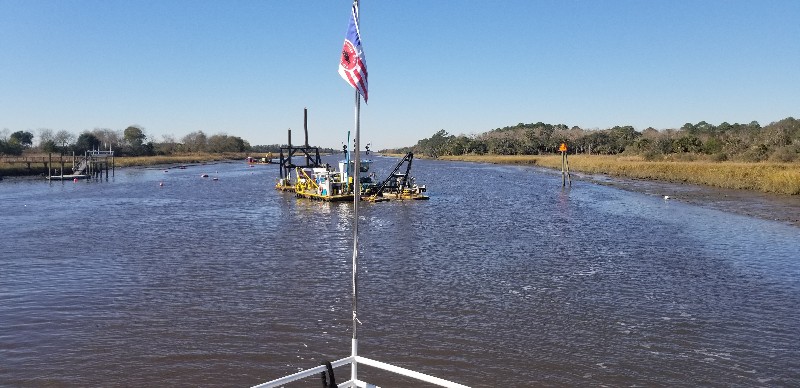
The water was like glass for most of the day...it was beautiful. Very little boat traffic... only the occasional small recreational boat... we did have one commercial boat hold us up for about 10 minutes in Watts Cut... Dredge Hennessey working at daymark 138... nice to see a dredge making this area deeper.
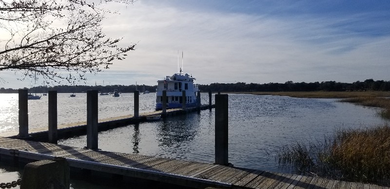
We arrived to Beaufort, SC at approximately 1500 and docked at the free day dock adjacent to the Beaufort Downtown Marina (
N32°25.846', W080°40.527') and took the dogs for a long walk around the area.
At 1700 after our walk we moved SAILS out to the mooring field and took a mooring ball for the night. Our position tonight is
N32°25.707', W080°40.890'. We traveled today for 8 hours covering 55.3 nautical mile averaging 6.9 knots.
Posted at 5:04 PM
CT to GA Day 18
Myrtle Beach, SC to St. Johns Island, SC

We left Osprey Marina this morning at 0700 just before sunrise. Forecast for the day was sunny and 10-15 knot winds. Did not get any sun until afternoon and the winds were as forecast.
We did get a nice boost once we hit the Waccamaw River... pushing us over 8.5 to 9.5 knots all the way to Georgetown. Just below Georgetown we lost the push when we turned into Estherville Minim Creek Canal and we were down to less than 6 knots... Then we entered the Yo-Yo area of inlets and rivers all the way to Isle Of Palms... running 8 knots plus for a few miles and then back to below 6 knots for a few miles. Once we hit Isle of Palms just before Charleston we had the current once again against us for the rest of the day.
We did manage to arrive to the trouble spots with a mid tide and rising so we had no issues in the McClellanville area and the stretch of ICW from Isle of Palms to the Ben Sawyer Bridge. We would of had some depth issues if we had not had mid tide plus... even so there were some real skinny areas.
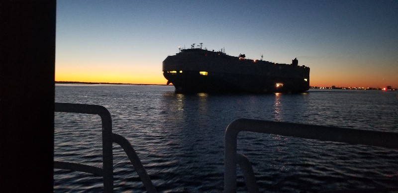
We ran a little longer day running a couple of hours past sunset... needed to get past the Ben Sawyer Bridge to clear all the shoaled trouble areas. Just after sunset crossing Charleston Harbor we met a huge cargo ship headed out to sea... per AIS info it was 700 ft long... a MONSTER specially when cross your bow a few 100 yards away.
Just south of Charleston we had to go through Elliott Cut... very narrow channel at the south end of Wappoo Creek taking you to the Stono River. We had current on our bow and the water was churning... slowed us down to under 4 knots... so about a 3 knot current against us... Susan hates this area when we have current... being dark made it much easier for her as she could not really see the water boiling from the current. Once in the Stono River we headed south for about a mile or so we were at our destination for the evening.
We arrived to St. Johns Island, SC and anchored just north of St Johns Yacht Harbor at approximately 1195. Our position tonight is
N32°45.389', W080°00.557'. We traveled today for 12 hours and 15 minutes covering 87.0 nautical mile averaging 7.1 knots.
Posted at 7:40 PM

